

Revisions allow you to track differences between multiple versions of your content, and revert back to older versions.

monitoring

Marine Directorate undertakes a wide range of monitoring covering many aspects of the Scottish marine ecosystem.

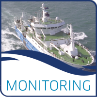
Monitoring is undertaken in Scottish Inshore Waters, using networks of volunteers and automatic recording equipment, as well as in Scottish Offshore Waters, using the MSS research vessels MRV Alba na Mara and MRV Scotia.

Marine Scotland Science also participates national monitoring programmes, such as:

  • UK Marine Monitoring and Assessment Strategy (UKMMAS)
  • UK Marine Environmental Change Network (MECN)
  • UK Marine Environmental Data and Information Network (MEDIN)

This group provides published data from monitoring these activities. For many activities, there are national or international standards for how the monitoring is undertaken.

License

UK Open Government Licence (OGL)

Other Access

The information on this page (the dataset metadata) is also available in these formats.

JSON RDF

via the DKAN API

Mapping risk from non-indigenous species in Scottish coastal and transitional waters - Interactive Maps

A html with three interactive maps
The interactive maps show the results of the Scottish Government Marine Directorate analysis to map areas of high risk from introduction of non-indigenous species (NIS) to assist in planning monitoring strategies for NIS.

The maps show the patches of highest risk from introduction and internal spread, those high risk patches within a marine protected area with a benthic feature, and the boundary of that MPA, and patches of highest risk of introduction and internal spread that also have a high risk of establishment by D. vexillum.

The three maps show these layers when all activities that can cause spread of NIS are considered, when only those associated with shipping or recreational boating are considered, and only those associated with aquaculture activities.
The map for shipping and recreational boating also includes a layer on the point location of ports, harbours and marinas.
The map for aquaculture also includes a layer on the point locations of active fish and shellfish farms.

doi: 
https://doi.org/10.7489/12569-1
Citation: 
Scottish Government, Marine Directorate. 2026. Mapping risk from non-indigenous species in Scottish coastal and transitional waters - Interactive Maps. doi: 10.7489/12569-1

Data and Resources

FieldValue
Publisher
Modified
2026-07-21
Release Date
2026-07-20
Identifier
f00272b8-42a5-47ce-a119-26060b0a6636
License
UK Open Government Licence (OGL)
Public Access Level
Public