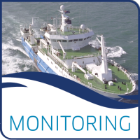
Samples are collected offshore from Stonehaven using Marine Scotland Science's catamaran, the Temora. The Stonehaven site has many student projects and supplementary projects carried out parallel to the regular monitoring due to its short distance from the Marine Laboratory in Aberdeen. Stonehaven is one of the two full coastal ecosystem monitoring sites in Scotland, the other being Loch Ewe on the west coast. E.g. both sites are being monitored for oceanography, water chemistry, phytoplankton, and zooplankton.
This dataset represents full resolution or high resolution data from the Stonehaven monitoring site.
Data and Resources
- Scottish Coastal Observatory - Stonehaven Site - Environmental datacsv
Scottish Coastal Observatory data is published under a digital object...
Preview Download - Scottish Coastal Observatory - Stonehaven Site - Secchi Depth datacsv
Scottish Coastal Observatory data is published under a digital object...
Preview Download - Scottish Coastal Observatory - Stonehaven Site - Zooplankton datacsv
Scottish Coastal Observatory data is published under a digital object...
Preview Download
| Field | Value |
|---|---|
| Publisher | |
| Modified | 2021-09-17 |
| Release Date | 2018-10-30 |
| Frequency | Annually |
| Identifier | 64760ff9-bdda-4bab-bb44-1d797a9a1d39 |
| Spatial / Geographical Coverage Area | POINT (-2.1105766296387 56.970918688337) |
| Temporal Coverage | 1997-01-01 to 2017-12-31 |
| Language | English (United Kingdom) |
| License | UK Open Government Licence (OGL) |
| Granularity | Weekly data collection |
| Data Dictionary | This dataset comprises of environmental and biological data collected following standard procedures and quality for the Scottish Coastal Observatory. E Bresnan, K Cook, J Hindson, S Hughes, J-P Lacaze, P Walsham, L Webster and W R Turrell (2016) The Scottish Coastal Observatory 1997-2013. Parts 1-3. Scottish Marine and Freshwater Science Vol 7 No 26. DOI: 10.7489/1881-1 |
| Contact Name | Marine Scotland |
| Contact Email | |
| Public Access Level | Public |


